Wednesday, December 22, 2010

The traveling meme

I caught this over at Looking for Detachment and thought I would add my two cents. I love traveling and seeing different places around the world..or at least different places of my part of the world.

The year started skiing on Red Mountain Pass. The winter ended with "normal" snowfall and good water all summer.

The big trip was flying to San Francisco for the birth of our first grand child. It is so much fun watching your kid being a parent!
I spent some time outside the Colorado Plateau in Ladore Canyon last summer. We followed the Green River down from Flaming Gorge dam all the way through Dinosaur NM. Some fun geology!
The Green River
Riding bikes in the Circle Cliffs of Utah
I took a couple of trips to DC. One working with NG who keeps us busy every second we are there.
We have always been interested in the ruins and rock art we see as we look at geology across the plateau. This summer we started getting serious about studying archeology. Here we are on a back country hike in Mesa Verde
The Colorado high country!
This fall I spent a lot of time in and around Moab. Whether it was bike riding, canyoneering or geology field trips, I learned more about the area this year than in many other field seasons.
We even caught a flash flood.


..and now it is winter again. Another full season of exploring the 4-Corners area.

Here is the Black Canyon
and the Red Mountain mining district.
We were able to catch one more riding weekend in Moab. Riding towards the La Sal mountains
No, I didn't crash. I just wanted my bike in the picture right below "the tombstone" a Wingate monolith.

Tuesday, December 7, 2010

What is in a name?

I am a bit slow on the uptake sometimes. It took me awhile to regularly use the Neogene and the Paleogene instead of the Tertiary period. I am dreading the day when the Quaternary will no longer exist. But last month while in the Canyonlands I noticed that one of my favorite formations apparently does not exist. No its not some revisionist erosion but a change in naming.

Elephant Canyon is a really fun little canyon deep in the Needles. The canyon bottom has miles of a classic grey/ greenish grey limestone that is full of obvious Permian fossils. It was always a joy to walk the length of the canyon right on the bedding plane between the limestone below and the Cedar Mesa sandstone above. The problem was that the mappable unit called Elephant Canyon Limestone is just not that easy to determine, so for years maps have shown that the Elephant Canyon was inter-fingered with the Halgaito Formation. But now, I see that the Halgaito formation is inter-fingered with the Lower Cutler.

To make the area a little more complicated, just a little bit to the west, the whole sequence of rock units is lumped into the Culter-undivided. Who thought up this system?

Not only does this give me a great excuse to do more research in my favorite place in the world, but I have to learn a new naming system. As any teacher will tell you, I have only so much room for names and that was filled way back in the mid-90's, so wish me luck.

The old stratigraphic column. Taken from the NPS web site. Notice down in the Permian that the Elephant Canyon is listed with the Halgaito Fm. You may have to click to expand.


The new stratigraphic column in miniature font. Please click it to read! Again, down in the Permian the Halgaito shale is now interfingered with the Lower Cutler.


Tuesday, November 30, 2010

What I love about the geology of home AW 29

This month's question comes from Ann and her musings. She asks what about the geology of home do you love or perhaps not like. This was an easy one! Back in 2000 when the world seemed lighter and fresher and open to all manners of imagination, we moved ourselves from perfectly good jobs to the western part of Colorado just to be near the canyons and mountains. I won't go into how the education job market has been in a steady decline since 2001, but I will talk about the geology.

How can you not love the San Juan Mountains of Colorado? Just in a single glance we can see sediment deposited in ancient seaways and ancient deserts, intense mountain building with its accompanied faults and folds and the topped off with all sorts of volcanic evidence from lava flows and ash deposits to hydrothermal mineral deposits then the whole mix was well glaciated just a short time ago. My only compliant is that the area is so complex that my small mind has trouble wrapping around some of the views. I keep saying that the rocks tell a story, well this story is a bit complex.

The story doesn't end there. Just a short distance west is the Colorado Plateau. A fantastic playground full of red rock canyons, fast flowing desert rivers and evidence of previous occupants in the form of ruins and rock art. I have been so fortunate to spend the last 9 summers teaching K-12 teachers about geology while canoeing down some of the west's most iconic rivers, often in the footsteps (or paddle strokes) of John Wesley Powell. We explore pre-Cambrian rock units in some of the rapids we negotiate. We have a campsite on a 1.5 billion year unconformity. Students can observe the difference between sandstone deposited by water and sandstone deposited by wind. Then, at the end, we play particles ourselves and float towards the Pacific Ocean. What an awesome place.

A high country lake near Silverton Colorado
Red Mountain #2, taken from Red Mountain #1 on the edge of the Silverton caldera. Obviously a heavily mineralized area with not-so-original names.
An arch found in the Cedar Mesa formation
That's me on top of Bow Knot bend, named by Powell as the Green River flows 7 miles to travel 600 yards through a very tight entrenched meander.
Entering spilt mountain in Dinosaur NM on the Green River

Monday, November 29, 2010

metamorphism of snow

Last weekend we took advantage of a few days off and some new snow up high. One interest of mine has been watching the snow pack change over the course of the winter. This was more than an academic exercise during my search and rescue days since the character of the snow pack was a big indication of avalanche potential.

Right now the snotel site indicates we are a little shallow in snow depth for this time of year. The crystals (yes I know I didn't even think of taking a picture) are all small and are fairly evenly sized through the snow piles. The only different sized crystals were found at the surface where a thin layer of surface hoar is forming.

What we will look for now is to see if the cold night time temperatures will continue creating new crystals that will influence how cohesive the snow will act. The fun part...I will have to keep skiing and snowshoeing through out the winter. I hope to have periodic updates as time goes on, so stay tuned.

Making first tracks through a meadow.
Climbing towards a mine dump-avalanche chute. It is just the right angle for a slide
Winter has come back to the Colorado Rockies

Monday, November 15, 2010

Moab, Rivers and Geology

Last weekend found me back in Moab...go figure. This time I was attending the Moab River Rendezvous a get together created by Plateau Restoration, a group dedicated to protecting and restoring native habitats on the Colorado Plateau. The rendezvous was a chance for lovers of the plateau and its rivers to get together and learn more about the place, do a service project, see some phenomenal movies and have a blast while doing it.

I could not get away for the whole event, but Saturday afternoon and Sunday were lots of fun. Saturday afternoon, the keynote speaker Wayne Ranney discussed his newest book on Carving the Grand Canyon. The river runners in the room were held spellbound by his description of what lava falls would have looked like in the beginning. Later that night were some old home movies, taken by Grand Canyon river runners in some of the high water years in the 1950's before any dams were in place...it was a different world.

Saturday's field trip into Arches National Park was the highlight for me. We walked out Bloody Mary wash to fossil falls which is on the Moab fault. Slickensides and fossils on the same stop! We then drove into the park and spent most of our time looking at the salt valleys (collapsed anticlines) that were so instrumental in making the modern landscape we see today. There was lots of discussion looking at the orientation of the salt valleys and their relationship to the nearby laccolith mountains, the La Sals.


The Moab fault up close. This is called fossil falls as the (Honaker Trail, Pennsylvanian period) limestone on the left is just chock full of crinoid parts, horn coral and brachiopods.
Looking across the Colorado River towards the La Sal Mountains a 25 million year old igneous intrusion.
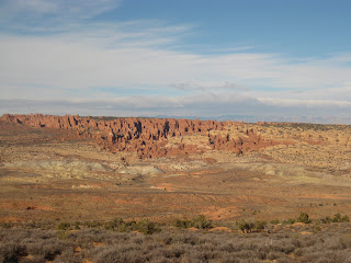
Looking across the salt valley into the fiery furnace. The salt valley is a collapsed anticline created by the movement of subterranean salt. The furnace is a maze of Entrada sandstone fins.
Not the best picture, but one of Utah's state emblems, Delicate Arch can be seen in the center of the image by its distinctive shadow. This view is also across the Salt valley collapsed anticline

Monday, October 25, 2010

A canyon flashes


Last weekend was spent in Moab UT at a literary festival about water. The weekend as a whole was a bit wet and fall in the desert never looked better. Saturday afternoon, however, the heavens opened and the town was treated to a good soaking with severe thunderstorms, a half hour downpour and hail. The canyon we were exploring did not have a gauging station but a nearby stream showed a 10 fold increase in discharge from about 7 cfs to 70 cfs in a matter of minutes. Actually the storm was a perfect addition to a festival about water.

Below are images of Courthouse Wash which originates in Arches N.P. Usually the water is clear, but the sediment load is easily seen as the silt is an especially red color.

A nearby gauging station showing a spike on Saturday October 23.


This is usually an easy river crossing.
A view from the other side.
Using a beaver dam to cross the river. The flash certainly impacted the integrity of the dam and my walking across it didn't help either.


Tuesday, October 19, 2010

Middle School in the mountains


The weather cooperated today and I was able to take a group of local 8th graders "out into the field". We looked at some nearby outcrops and tried to describe their characteristics and decide their rock type. It is lucky for us that there is quite the geology field trip right out the front door.

Ms. J, their teacher and I were also getting the kids to formulate some simple questions that they can research and perhaps even answer. Their teacher has created an impressive science program that has the kids doing some real world research both in the field and library.

The big picture of the field trip location.
Gratuitous picture of my truck with geological background
The class sitting on limestone outcrop

Monday, October 11, 2010

A trip to Grandmothers house- Colorado style

Last weekend we took a trip to Colorado's Front range to visit some relatives. Since we are having a fantastic fall we took the scenic route. the idea came as we were driving back, so all of the images were found online and do not represent actual conditions. It did snow, but accumulations were in the low inches.

McClure pass from the North Fork of the Gunnison drainage to the Roaring Fork of the Colorado drainage
From the Main stem of the Colorado drainage to the Blue River drainage
From the Blue River drainage to the Williams Fork of the Colorado River drainage
Up and over the Continental Divide
We spent our time between Loveland and Fort Collins for a few days and then headed back. This time we used Interstate 70 to get us into Summit County where we lived during the 1990's.

Back over the Continental Divide to the west side
...and back again to the east side as we traveled from the Blue River drainage to the South Platte Drainage.
No, there was no snow when we traveled across Trout Creek. This small pass divides the S. Platte and the Arkansas river drainages.
...and for the last time, across the Continental Divide towards the Pacific Ocean and down into the Gunnison River drainage and back home.
The Gunnison River takes a strange turn into the Black Canyon. The highway department (and railroads and old trails) thought it would be easier to drop down into the Uncompahgre drainage instead of following the Gunnison River.

Friday, September 24, 2010

AW 27 “What is the most important geological experience you’ve had?”

This month's Accretionary Wedge is all about important geological experiences. I am not sure if this is the most important or just one that hit my brain at the same time I took some pictures, but the theme has existed ever since I took Geology 101.

I entered the University of Colorado with geology on my mind. I never took anything beyond Earth Science as a freshman in high school and now I was in a real university with a geology department. From the first day I found that there was a story to be found in the rocks. By the end of the first semester, I could start to tease out those stories myself...as long as they were simple stories.

My important geological experience was that with some simple tools I could interpret a rock, a outcrop, a road cut and even a mountain range. This idea shook me up. Here is something that happened a long time ago and with a few rules of physics I could construct a story about the origins of a landform...I was hooked.

This week, I have been working on some landscaping in the backyard. Part of the plan needed some small river cobbles and even though I hate the idea of paying for rocks, it sure was easier to get a truck to dump 3000 pounds (1361 kg)in the driveway. While moving the rocks, I started looking at them ( surprised?) Since the gravel pit is on the Uncompaghre River I knew the source area and I picked out examples of the different rock units I have played in over the years. There was a cobble from the Ancestral Rockies caught in the Cutler formation, some Ouray Limestone and as I would expect lots of examples of the San Juan Tuff. I washed some up and placed them in chronological order. What a geo-geek. But then it was back to work and only a few pictures were taken.

I now take this show on the road and invite all kinds of kids to try their hand at telling the story in the rocks.


The headwaters of the Uncompaghre River near Red Mountain Pass

The 1361 kilogram pile in the driveway.
A small collection before I had to get back to work.