Monday, March 10, 2025

Diversity in all of nature

 Either in class or in the field I notice that we have a tendency to describe rock units as homogeneous rock types.  Sure, we throw in little bits of sandy limestone or shaley sandstone or what ever, but what many people hear is just this rock is a large chunk of sandstone. Never mind that we can find little bits of all kinds of things in there.

Just like we would be amiss if we assumed that complex biological systems would never be strictly homogenous or even straight binary, we should never expect the rock outcrop in front of us to contain only one type of material.  

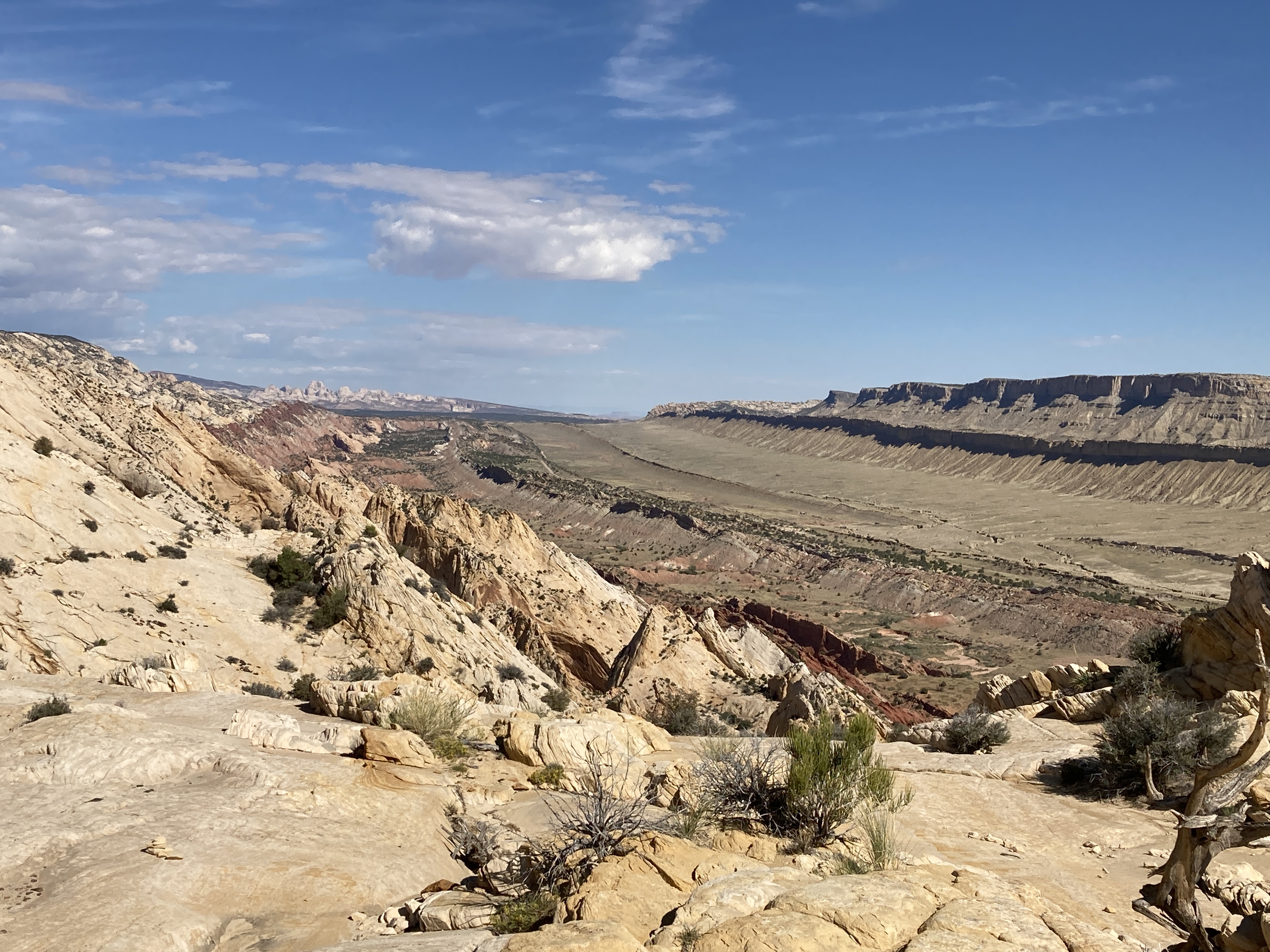
Case in point. This week I was wandering around the Temples area in Capitol Reef National Park.  These towering monoliths are mostly Entrada sandstone, the same rock unit that makes up most of the arches in Arches National Park.  But they really don’t look similar, how can they be the same?


 Here the Temple of the Sun and the Moon show a highly eroded monolith that looks like a heavy rain could wash the whole thing away.


Here, at the windows area in Arches National Park, the same rock unit, Entrada sandstone, looks pretty solid, except for that big hole in the middle, and ready to stand for a few more millennia. 


The key is during deposition. The Capitol Reef rocks were laid down much closer to the ocean as compared to the Arches sandstone. Otherwise, they are the same age and composed of the same stuff. Just a little difference in placement makes a big difference in presentation. 

So, remember when studying the natural world, most anything is not as simple as we want to make it. 

Saturday, April 8, 2023

Wednesday, April 5, 2023

Monday, March 27, 2023

Wednesday, June 26, 2013

West Fork Complex fire

from 40 miles away.


Spent the day up high yesterday (much cooler!) and watched the afternoon heat amp up the West Fork fire. It was barely visible in the morning but as the afternoon wore on we could watch the cloud grow larger. What is needed is a good rain storm and the forecast doesn't look all that favorable just yet.

Thursday, June 6, 2013

Studying stream velocity in the Grand Canyon

How much fun is a Grand Canyon raft trip for a geologist? Well...plenty! I had the opportunity to float the Colorado River through the famous canyon a few weeks ago. I had plenty to look at and to explore but one thing literally took the oar right out of my hand. 

While rowing even the easy sections I could easily feel the current push and pull my oar with practically every push I made.  Frankly I am used to sections of the upper Colorado where there is much less force.  Was I being just lazy, or was there something else at work? 

The week we were on the river, the discharge at Lee's ferry, (mile 0 of the Grand Canyon) was a steady 8,000 cfs (cubic feet per second) for a study the NPS was conducting. Discharge is simply a measurement of how much water is flowing past a certain point. here in the US we measure discharge in cubic FEET/second, while the rest of the world measures cubic METERS pr second...oh well.

Often when I am on the upper Colorado, the discharge is similar 5,000-9,000 cfs. This could account for some of the extra force I was feeling on the oars, but not all of it. 


 Rowing through the Muav Gorge, looking serious and trying to avoid obstacles.


 Navigating the famous "Black Rocks" of the upper Colorado River, again looking serious and trying to avoid obstacles.


The diagram below, borrowed from California State University, shows that the velocity is some how proportional to the wet area (depth times width).  Looking through some old notes when I would have students measure the width and depth of the upper Colorado to calculate discharge, I could see that there is little appreciable difference in these two physical parameters between the upper Colorado and the Grand Canyon.

Thank you CSU Long Beach


However, the one physical parameter I found that was different was river gradient. Looking through my river guides and doing some simple math I found that the upper Colorado stretch has a gradient of 3+ feet/mile while the section of the Grand Canyon has a gradient of almost 7.5 feet/mile.

Could this be the reason I found the oars being snatched out of my hands?


Thursday, May 16, 2013

yet another example of a cap rock


Last week we were camping along the Colorado River above Moab Utah when we saw these pillars showing how a more resistant chunk of sandstone will protect the less resistant shale below. The last blog post showed how the more resistant White Rim sandstone was left standing even after the softer Organ Rock shale had all eroded away leaving a really fun arch to visit.


Differential erosion of the Cutler formation along the Colorado River

Wednesday, May 8, 2013

Regime change

What a fun place, Musselman Arch in Canyonlands National Park.  The arch is composed of the White Rim sandstone a Permian aged wind blown classic sandstone in a near coast environment. Sandstone is fairly well cemented together making a rock unit somewhat resistant to erosion. Right below the White Rim you can see a reddish (isn't almost everything in the Canyonlands red?) brown silt-mud stone formation. This shaley material is poorly cemented making it fairly easily eroded. You can see how the sandstone in the arch is lasting much longer than the missing shale/silt/mud stone found below the arch. 


So the White Rim sandstone is acting as a cap rock to the softer Organ Rock found below.

Musselman Arch is found along the White Rim mountain bike trail. You can ride down the Shafer trail to the arch and back in a day, but the 1300 vertical foot climb back up is an interesting way to end the day's ride.

Thursday, March 28, 2013

Joshua Tree boulder factory


Spent some time in Joshua Tree last week. It has been a long time since I have played in so much granite. In fact it was way back in grad school and we had a professor who always brought the freshman students up to his idea of a "boulder factory" We would spend a little time discussing chemical weathering and then let the students climb around a little bit to experience the sharp quartz minerals left behind.

This was the same thing...only I was the one climbing around. You can clearly see how the once monolithic rock has jointed to make very regular blocks with the resulting acidic water rounding the blocks into spheres. In some cases, you would swear these were very large river rocks eroded down by the movement of water.


 Eroded monoliths with quartz intrusions. These intrusions are harder than the surrounding country rock. In some cases the intrusions were vertical making a quartz wall.
Very spherical boulders. These boulders were once part of a larger monolith similar to the image above.   A series of joints, both vertical and horizontal made regular shaped cubes of granite. Acidic water running through the cracks chemically eroded the feldspars into clay minerals that have since been flushed out leaving behind very smooth spherical boulders.

Friday, March 15, 2013

Did you see it?


4 days camping in the desert
4 days with great open views to the west
4 days with clouds in the west right at sun set and lasting most of the night


Comet Pans STARR borrowed from the NASA.gov web page

Sunday, March 10, 2013

Where is all the snow?


Anyone who has looked through my past blog posts have seen my fascination with our snow pack, whether how big a year we are having or how low a year we are having or about its ability to slide.

This year, like last year is all about how little we have. The graph below, courtesy of the NRCS, shows  the snow totals for the Gunnison River drainage in Western Colorado. The line in the middle is average. The dark line that ends suddenly is this year. Not only are we below average, but we are below last year, a bad year. Note how the slope of the two lines are almost parallel. This suggests that the winter storms are in line with normal. But, look at when we started accumulating snow. The new snow year started last October 1. It took until mid December before any appreciable snow covered the ground. Look at last years graph. It was about this time last year when the snow started to melt. Way ahead of schedule. 

I know that two years do not make a trend. I hope that the next two years will be as high as these years are low, just look at two years ago with a record breaking snowfall. But looking at these past two years with everything else happening around the planet, I wonder if we are starting to see the new normal. Time will tell.


Saturday, February 2, 2013

A naming happenstance

I just learned today that two of my favorite areas are connected by a common name. The Cutler formation in Western Colorado and Eastern Utah is the Permian deposits of a high area that is now long gone. The Cutler is named for Cutler creek near Ouray Colorado. Also near Ouray Colorado is a very picturesque peak named Mt. Abram. This peak is actually just a high point on a ridge that is part of the Red Mountain mining district. I visit, play in and study both locations quite often.

Today I found that Mt Abram was named after Abram Cutler who also had Cutler creek named after him. So, both locations named however indirectly after the same person.

I thought that was pretty cool.


An outcrop of the undivided Cutler formation in eastern Utah


Mt. Abram as seen from Ouray Colorado

Saturday, November 3, 2012

Flash Flood Man

 Last week I had the great fortune to spend time wandering around the Cedar Mesa sandstone (one of my favorite Permian deposits) Usually I am content to examine the red and white layering. The white a nice beach sand and the red debris from the Ancestral Uncompahgre Mountains.  But this time we happened to spy some rock art high on the Cedar Mesa cliffs.

This was one of my favorite panels. The cliff face is directly above the confluence of three nice sized drainages.


Below is a close up showing the image of arms help out to the side and wavy lines extending across the picture. It doesn't take much imagination to see that the arms were once connected to a body that has ironically been dissolved by water running down the cliff face. Often times these wavy lines indicate water and so this image looks like a figure standing in belly button deep water. 


Given the location of this image at the confluence of three drainages it is not a big stretch to suggest that this figure was made to warn people of high water.  Below is a flash flood sign taken from a National Park web site. There are just a few similarities between the ancient rock art and the modern traffic sign.


Tuesday, October 23, 2012

homogeneity of rock units


Over the years I have noticed that students have a tendency to assume that rock units are very homogeneous in both shape and texture. They expect the Navajo sandstone to be made of white sand grains in distinctive sand dune cross bedding everywhere they look. When you point out "different" structures in the middle of a rock unit they get confused ( just for a short time). Most of my students also seem to expect sedimentary rock units to be of equal thickness throughout their extent. I guess I can't blame them since I am just as guilty of using these stratigraphic columns that show nice rectangles for rock units.   The White Rim sandstone is a great example of a rock unit that noticeably gets thinner as you ride east. 

A few weeks ago I had the awesome pleasure of riding the White Rim Trail in Canyonlands National Park, an 80 mile jeep track created by the atomic energy commission in the 1950's which has made more money as a tourist destination than all the uranium ore pulled out.


   The White Rim is a resistant rim of Permian aeolian beach sand that delineates the inner canyons of the Green and Colorado Rivers.

 Early in the trip you can see the thickness of the White Rim sandstone.  There is a bicycle on top of the cliff in the distance for scale...It is a big cliff.
 Again, there are dots across the gorge showing the scale of the White Rim cliff.
 Halfway through the trip you can see that the formation thickness is much less than in the first two images.
Here, near the end of the trip we can see the thin white line, all that is left of the White Rim just pinches out in the Cutler formation. The beach sand ends and the debris running off the Ancestral Rockies takes over.

Friday, September 14, 2012

arborglyphs

While hiking around the San Juan Mountains we sometimes see some ornate tree carvings usually from sheep herders from the last century. These carvings tell us about the lonely life in the mountains these men lived.  Today I was riding down an old road when I saw what looked like a rock hammer carved into an aspen tree. I can't help but wonder what the story is behind this particular arborglyph.


Wednesday, September 12, 2012

The half moon moraine

While climbing to the top of Colorado I turned around and saw this great example of the moraine we had climbed earlier in the morning. 


The cirque above is now empty of any snow.