Monday, August 16, 2010

"The Blowout"

I spent yesterday hiking above and west of the town of Ouray Colorado. At one point we had an awesome view of what is locally known as "the blowout". This highly mineralized area is actually a Larimide intrusion effectively marking the center of the Ouray Mining District. At about the turn of the era (late Cretaceous-early Paleogene), Colorado was upset with numerous magma invasions along an ancient (Precambrian) structural zone, called the Colorado Mineral Belt. The blowout is just our little part of the whole belt. The mines in the area are all related to the laccolith that forms the blowout. I found an older paper, written in 1947 that suggests that the center of the mineralization was mainly magnetite-pyritic ores with little gold and silver but that just a short distance outward ores containing pyritic gold and even some native gold could be found. As this fall rolls around, I hope to climb up and explore some of the mines in the area and will try to share my findings. My background is notoriously blank in geo-chemistry and so as usual I will keep things simple.

I just saw that this is post #100!

The blowout, now known as a source of gravel when the afternoon summer thunderstorms deluge the small catchment area.
Another view. You can just make out parts of town in the lower left.

Monday, August 9, 2010

Forgot the camera

Last week was spent on a favorite section of the green River through Labyrinth Canyon. Because I have traveled this stretch so many times, I decided to leave the camera at home.

well

The flash flooding was awesome. Whole sand bars gone, with new ones created downstream. Almost every side canyon through Labyrinth had flashed leaving large holes through the sand that is normally found as each tributary reaches the main stem.

A lightning storm that is easily the best light show I have ever experienced. (of course lightning is notoriously difficult to catch on digits)

That will teach me.

Sunday, August 1, 2010

Class time

As in most states, public K12 teachers must collect some college credits every so often in order to keep their license current. A crazy notion in Colorado is that I can't get credit for the classes I teach, so I signed up for a few classes to reup my license for the next few years. Not surprisingly, I decided to take a geology class that uses river craft to explore an area.

This class used rafts and canoes to float the Green River from the Flaming Gorge Dam through the Gates of Ladore into Dinosaur NM. It was fun exploring a site close to where I do most of my work. Many rock units were the same as on the Colorado Plateau while others were new to me. What fun! Geology aside, it was interesting to watch an instructor and see how she taught. The canoeing and rafting wasn't hard to take either. I know have my requisite credits and soon should have my license approved for the next five years.


The geologic time walk. The instructor took us on a little hike with each step as one million years, giving a whole new meaning to "that was one small step for a man". It is always fun to see how different instructors try and explain the vastness of time.
The Green River in Ladore Canyon. The Ladore formation is a Cambrian sandstone that lies above the Uinta Mountain Group, a late Proterozoic sandstone/conglomerate. Between the two is a 480 million year unconformity.
Ducky-ing into Split Mountain. One of my highlights was to look at the same evidence as John Wesley Powell and see how he came up with his two working hypothesis of an "antecedent canyon" or a "superimposed canyon".
The antecedent canyon had the river channel established first. Subsequent uplift was slow enough that the river followed its original channel as it cut deeper.
The superimposed canyon had geology first, where bedrock was deformed and then buried under sediment. At a later date, a river eroded through the sediment and eventually cutting into the harder bedrock creating a conundrum for hydrologists.

Powell's notes suggest he leaned towards the antecedent method while more modern reports lean the other way towards a superimposed canyon.
Deformation at the entrance to Split Mountain. The Split Mountain Anticline. The opposite side of Split Mountain can be seen with one of Ron's gigapan images.

Wednesday, July 21, 2010

Games Geologists Play

While teaching classes on western rivers, I often give descriptions of the upcoming rock units. After describing mappable units, grain size, shape, color and other macro-characterizations, I ask them to determine where the next rock unit appears as we float the river. The winner often receives an extra Oreo cookie at lunch. (A game needs a prize) Other games have included: find the river, and the ever popular where are we.

Can you find the break between the Ladore formation and the Madison limestone?
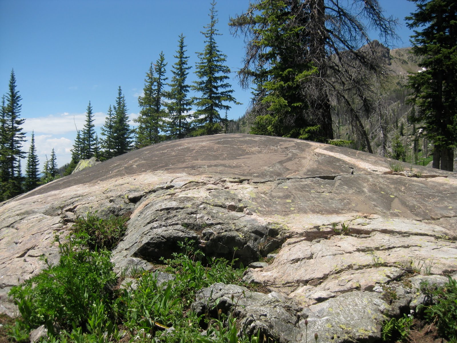
Last week we were traveling in Northern Colorado and found ourselves looking at some fantastic glacially polished rock. I was explaining to my ever-patient wife about the life and death of glaciers when we created a new game: Find the Equilibrium Line.

The equilibrium line divided the ice sheet into two parts. The upper section is where material was being added to the glacier as more snow was accumulating than melting. We can observe paleo-accumulation zones from the presence of erosional features- such as glacially polished rock.
The area below the equilibrium line is where more material was melting than being accumulated. Because there was an excess of material, ice moved from above the equilibrium line to below the equilibrium line. Paleo-ablation, or melting zones can be determined by observing depositional features such as a moraine. (The image below was shamelessly right-clicked from a google image search as it showed a moraine way better than any of my pictures.)The trick is to find the point where erosion ends and deposition begins.
Here, the elevation of the paleo-equilibrium line is is roughly 11,300 feet above sea level.

For extra cookies, or credit. a very rough estimate of the paleo-climate can be determined with some simple calculations. The difference between the "modern" equilibrium line ( approximately 14,000 feet (a number created a long time ago while in grad school) and the "paleo" equilibrium line is 2700 feet. The dry adiabatic rate is roughly 3.5o F/ 1000 feet, giving us a rough temperature difference between the ice age maximum and now would be 9o F.

I know that there are a multitude of factors not being taken in consideration, but this seems an easy exercise where students can observe geology, do some simple calculations and go home with an answer that makes sense.

And, of course the winner gets an extra Oreo cookie.

Monday, July 19, 2010

Part of the "Why I blog" series

Last month between trips in Utah, one to Grand Staircase and the other to Dinosaur NM, I quickly penned a guest blog for the plainspoken scientist. It took them awhile to fix all of my grammatical mistakes, but it is up and running now.


I hope to get a new blog post up soon...but it is summer.

Tuesday, July 6, 2010

Geological interpretation in a biological world

We spent much of June exploring both front and back county areas of the Grand Staircase NM. Our journeys took us from Bryce Canyon to the Circle Cliffs. This is an amazing country and we are so fortunate that much of it is protected as a national monument.

However, it appears, to me anyway, that much of the interpretation of the natural world is done by biologists. We visited Bryce Canyon with its hoodoos of the Claron Fm eroding out of the plateau. As we walked about I was expecting that most interpretive signs would be about geology...but no. We did learn about the harsh conditions the trees are subjected to as well as how the animals survive in such a dry climate. While biology is quite important, I was hoping for more "rock" signs for obvious reasons. Nothing registered in my mind yet, that is until we visited Escalante Petrified Forest State Park. Once again, with "petrified forest" as the title feature I expected a geology inspired hike. Hiking up the marquee trail we found some cool basaltic boulders left over from eruptive excitement on the nearby Boulder Mountain. Later in the hike we observed handfuls of nodules eroding out of a Navajo Sandstone outcrop. And, of course, all along the hike we were treated to fossilized trees scattered over the hillside. Our little trail guide mentioned only one of these observations, that of the petrified trees. Interestingly, a team from Utah State University has created a fantastic geologic trail guide for the same trail, but copies were not available at the visitors center and I have only seen them online.

A new outreach goal of mine is to help our federal land naturalists with more geologic interpretation.

Bryce canyon at sunrise. The Eocene aged Clarion Fm is a colorful freshwater limestone.
A fantastic cross section of the area from my favorite Utah State Park.
Petrified tree eroding out of the Morrison Fm
nodules from the Navajo Fm
Basaltic boulders transported from nearby Boulder Mt and the Aquarius Plateau

Thursday, June 17, 2010

National Park meme

I am great fan of the national parks. I had to jump on this one. The rules are simple: Bold the ones you have visited, and italicize the ones you’ve never heard of before.

Most visited:
10: Glacier
9: Acadia
8: Grand Teton, climbed the Middle Teton years ago, no crowds, in fact no others.
7: Cuyahoga Valley , yes the river that caught fire is certainly doing better now
6: Rocky Mountain, I was a ranger here for 3 summers. Enjoyed every minute
5: Olympic
4: Yellowstone
3: Yosemite
2: Grand Canyon
1: Great Smoky Mountains

Least Visited:
10: City of Rocks NR, Idaho
9: Cumberland Island NS, Georgia
8: Florissant Fossil Beds NM, Colorado
7: Chiricahua NM, Arizona
6: Tonto NM, Arizona
5: Dry Tortugas NP, Florida
4: Katmai NP & Preserve, Alaska
3: Kalaupapa NHP, Hawaii
2: Hagerman Fossil Beds NM, Idaho
1: Russel Cave NM, Alabama