Wednesday, July 21, 2010

Games Geologists Play

While teaching classes on western rivers, I often give descriptions of the upcoming rock units. After describing mappable units, grain size, shape, color and other macro-characterizations, I ask them to determine where the next rock unit appears as we float the river. The winner often receives an extra Oreo cookie at lunch. (A game needs a prize) Other games have included: find the river, and the ever popular where are we.

Can you find the break between the Ladore formation and the Madison limestone?
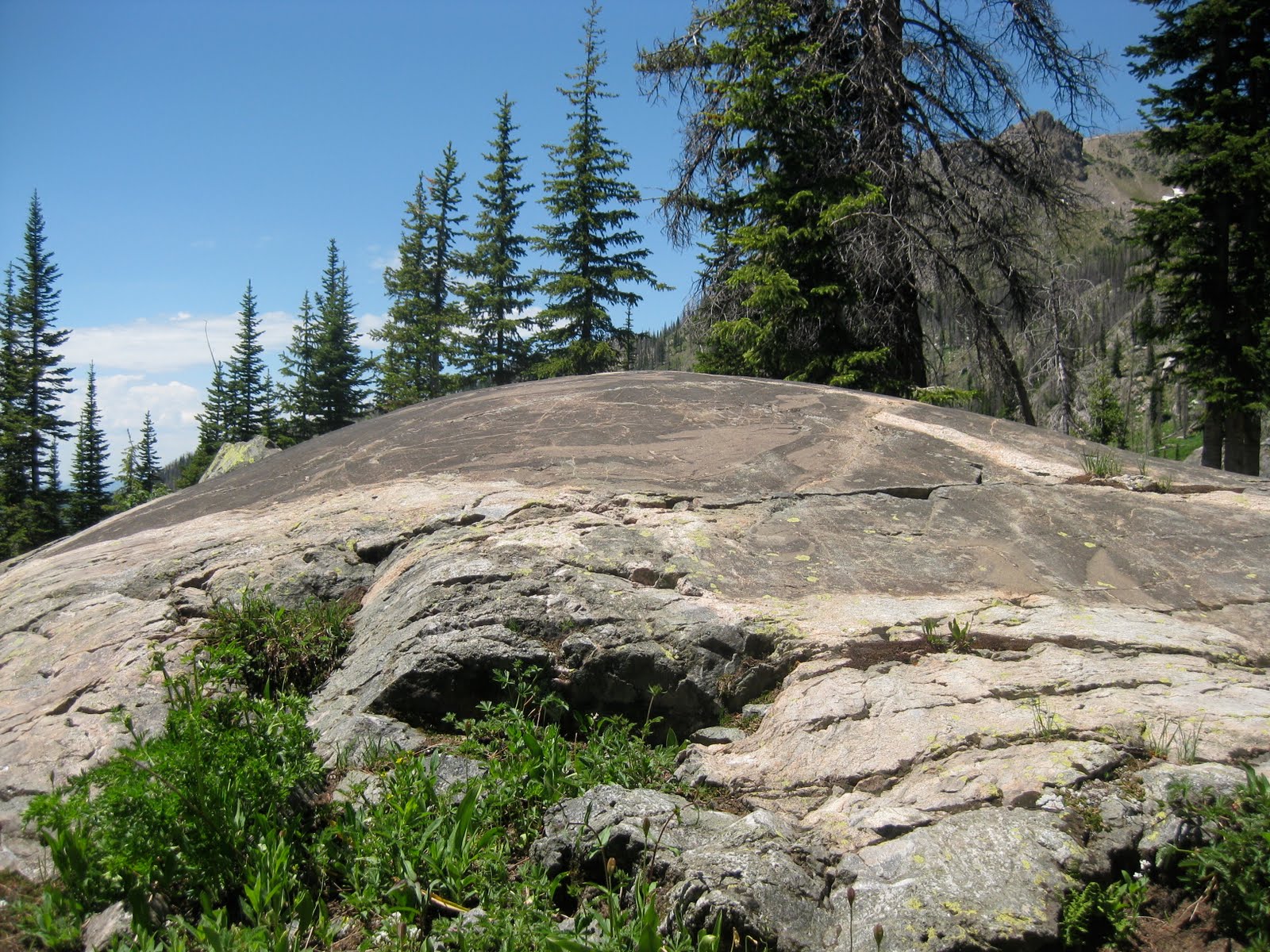
Last week we were traveling in Northern Colorado and found ourselves looking at some fantastic glacially polished rock. I was explaining to my ever-patient wife about the life and death of glaciers when we created a new game: Find the Equilibrium Line.

The equilibrium line divided the ice sheet into two parts. The upper section is where material was being added to the glacier as more snow was accumulating than melting. We can observe paleo-accumulation zones from the presence of erosional features- such as glacially polished rock.
The area below the equilibrium line is where more material was melting than being accumulated. Because there was an excess of material, ice moved from above the equilibrium line to below the equilibrium line. Paleo-ablation, or melting zones can be determined by observing depositional features such as a moraine. (The image below was shamelessly right-clicked from a google image search as it showed a moraine way better than any of my pictures.)The trick is to find the point where erosion ends and deposition begins.
Here, the elevation of the paleo-equilibrium line is is roughly 11,300 feet above sea level.
For extra cookies, or credit. a very rough estimate of the paleo-climate can be determined with some simple calculations. The difference between the "modern" equilibrium line ( approximately 14,000 feet (a number created a long time ago while in grad school) and the "paleo" equilibrium line is 2700 feet. The dry adiabatic rate is roughly 3.5o F/ 1000 feet, giving us a rough temperature difference between the ice age maximum and now would be 9o F.

I know that there are a multitude of factors not being taken in consideration, but this seems an easy exercise where students can observe geology, do some simple calculations and go home with an answer that makes sense.

And, of course the winner gets an extra Oreo cookie.

Monday, July 19, 2010

Part of the "Why I blog" series

Last month between trips in Utah, one to Grand Staircase and the other to Dinosaur NM, I quickly penned a guest blog for the plainspoken scientist. It took them awhile to fix all of my grammatical mistakes, but it is up and running now.


I hope to get a new blog post up soon...but it is summer.

Tuesday, July 6, 2010

Geological interpretation in a biological world

We spent much of June exploring both front and back county areas of the Grand Staircase NM. Our journeys took us from Bryce Canyon to the Circle Cliffs. This is an amazing country and we are so fortunate that much of it is protected as a national monument.

However, it appears, to me anyway, that much of the interpretation of the natural world is done by biologists. We visited Bryce Canyon with its hoodoos of the Claron Fm eroding out of the plateau. As we walked about I was expecting that most interpretive signs would be about geology...but no. We did learn about the harsh conditions the trees are subjected to as well as how the animals survive in such a dry climate. While biology is quite important, I was hoping for more "rock" signs for obvious reasons. Nothing registered in my mind yet, that is until we visited Escalante Petrified Forest State Park. Once again, with "petrified forest" as the title feature I expected a geology inspired hike. Hiking up the marquee trail we found some cool basaltic boulders left over from eruptive excitement on the nearby Boulder Mountain. Later in the hike we observed handfuls of nodules eroding out of a Navajo Sandstone outcrop. And, of course, all along the hike we were treated to fossilized trees scattered over the hillside. Our little trail guide mentioned only one of these observations, that of the petrified trees. Interestingly, a team from Utah State University has created a fantastic geologic trail guide for the same trail, but copies were not available at the visitors center and I have only seen them online.

A new outreach goal of mine is to help our federal land naturalists with more geologic interpretation.

Bryce canyon at sunrise. The Eocene aged Clarion Fm is a colorful freshwater limestone.
A fantastic cross section of the area from my favorite Utah State Park.
Petrified tree eroding out of the Morrison Fm
nodules from the Navajo Fm
Basaltic boulders transported from nearby Boulder Mt and the Aquarius Plateau

Thursday, June 17, 2010

National Park meme

I am great fan of the national parks. I had to jump on this one. The rules are simple: Bold the ones you have visited, and italicize the ones you’ve never heard of before.

Most visited:
10: Glacier
9: Acadia
8: Grand Teton, climbed the Middle Teton years ago, no crowds, in fact no others.
7: Cuyahoga Valley , yes the river that caught fire is certainly doing better now
6: Rocky Mountain, I was a ranger here for 3 summers. Enjoyed every minute
5: Olympic
4: Yellowstone
3: Yosemite
2: Grand Canyon
1: Great Smoky Mountains

Least Visited:
10: City of Rocks NR, Idaho
9: Cumberland Island NS, Georgia
8: Florissant Fossil Beds NM, Colorado
7: Chiricahua NM, Arizona
6: Tonto NM, Arizona
5: Dry Tortugas NP, Florida
4: Katmai NP & Preserve, Alaska
3: Kalaupapa NHP, Hawaii
2: Hagerman Fossil Beds NM, Idaho
1: Russel Cave NM, Alabama

A busman's holiday...a Geologist on Vacation


We camped for 12 nights, visited 3 National parks, 2 wilderness areas and one fantastic national monument. We hiked about 80 miles and rode bikes for an additional 130 miles using some single track and lots of remote desert jeep tracks. We were also able to enjoy the melt water from an above average snow pack in Central Utah. A few of the canyons we visited sported full on rivers that felt so good in the usual desert heat.


To set the scene.
Riding the trails in Kodachrome State Park. The Entrada sandstone normally erodes in some great shapes, but here, the strange "sand pipes" add an interesting structure. Up close you can see that the sand pipes have a great variety of grain sizes compared to the run-of-the-mill sand stone suggesting a little more water in their formation.
Riding in the Grand Staircase. Entrada cliffs in the foreground. The cliffs Clarion limestone in Bryce Canyon in the back ground.
Wading the Escalante River. Above normal snowpack provided a full river. I used the USGS water level email service to keep me informed of the water levels prior to our visit.
Biology n the foreground and Chinle Fm in the background. The desert was in bloom everywhere we went.
Riding in the circle cliffs. The west side of the waterpocket fold in the background. The roads are made entirely of eroded shale making for a great riding surface in the dry. There was plenty of evidence that people had been caught way out here in the rain just the week before.

Friday, June 4, 2010

What do I work on??

I had the pleasure of dinner last night with Ron Schott after following his tweets across the country. Sitting in the backyard enjoying some beverages before dinner Ron asked me what is it exactly that I do? I found that a difficult question. My career as a high school teacher has certainly allowed me to take many kids into the field and show them the wonders of our planet...but what about now?

I guess what I do now is to try and explore as much of my neighborhood (the 4 corners) as time allows. My research is all about what I am interested in, that day. High school teachers don't have to publish :) and so I follow my whim.

What do I work on? Getting outside, walking, biking, climbing or traveling on a river. Observing interesting sights and giving a try at interpretation. Reading books about my region. and lastly sharing what I have found out. So, the month of June will be in the field, or God's navel if you are an Ed Abbey fan. Plans include backpacking along the Escalante River, mountain biking in the Grand Staircase and on Cedar Mesa and rafting through the Gates of Ladore. I am of course traveling with my wife, who told Ron, yes every day is a field trip.

See you on the other side.

Tuesday, June 1, 2010

1st peak of the season

Memorial Day was a blue bird Colorado day. With the weather cooperating, we decided that it was a good day for our almost-traditional climb of Baldy Peak. The peak can be found just south of Ridgway and just north of "The Blowout" the eroded remnants of a Laramide age intrusive stock. Baldy itself is made primarily of Mancos Shale with a few outcrops of San Juan Tuff at lower elevations.

The climb was a delight, the weather was warm with just a slight breeze (this spring has been exceptionally windy) and we saw no other people until almost all the way back to the trail head. There was plenty of mountain lion evidence but no bear scat. With such a large deer population, it isn't too surprising to see lion spore.

Here is a USGS bench mark that actually has the name and elevation.

The calendar might say June 1, but at 10,000 feet it is still spring. Pasque flowers lining the trail
Eating lunch on the summit, contemplating the universe
The two 14'ers in the background are Wetterhorn and Uncompaghre. The aspen trees are just starting to show leaves at this elevation. The large areas of meadow suggest a more basic soil made from the erosion of the Mancos shale.