A friend was asking about some interesting places to visit on the Colorado Plateau. I gave her some names of trails, canyons, drainages and ridge lines that I thought were fun. When it came time for directions I didn't use the typical cardinal directions, but instead used the location of the three main laccolithic mountain ranges of the Colorado Plateau. Needles to say...she gave me a hard time. Again, needless to say I gave her a little geology lesson concerning these mountain ranges.
In the late Paleogene-early Neogene, igneous rocks intruded into the area, "doming up" the overlying sedimentary rock creating laccoliths across the Colorado plateau. Over time, much of the overlying strata eroded away leaving the root of igneous rock surrounded by steeply dipping sedimentary rock. We just don't see much of a dip in sedimentary rocks in much of the plateau.
These small mountain ranges have captured some of the scarce water vapor that has crossed the arid Colorado Plateau creating many of the systems of canyons we see today.
These mountain ranges are also great landmarks as they can be seen from many parts of the eastern portion of the Plateau. It is comforting when you emerge from a canyon, look to the west and see the Henry Mountains. That and a GPS can get me to the car.
The Abajo Mountains west of Monticello.
 The Henry Mountains. One of the last areas explored in the US.
 Riding towards the La Sal Mountains. Right outside of Moab. These mountains are a beacon all across this portion of the plateau.
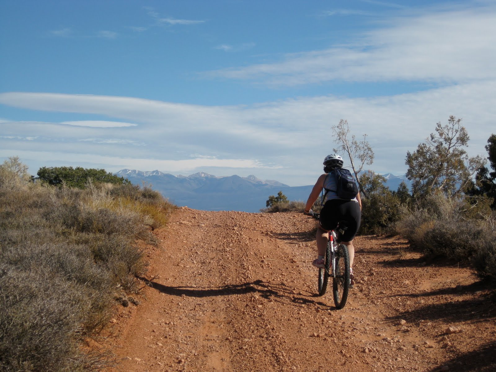 Looking south towards the Abajo mountains.

2 comments:
Nice post about the Colorado Plateau's laccoliths, which in college I learned to call "a hot hump between the sheets." They are wonderful features and great landmarks. I am sure you know this quote but it always worth repeating, particularly in its full text.
"The feeder to the Trachyte Mesa laccolith has a
distinctive form and some may wish it named. Because the form has certain resemblances to the woody structure of the cane cactus the name cactolith might be used and defined as a quasi-horizontal chonolith composed of anastomosing ductoliths whose distal ends curl like a harpolith, thin like a sphenolith, or bulge discordantly like an akmolith or ethmolith. However, as Arthur Holmes (1920, p. 5) has pointed out: '' * * * Brevity of expression is by no means an unmixed blessing, and the one word may require a whole paragraph of explanation."
Charles Hunt, USGS PP 228
Hi, Karl Stevens here. I took the photo of the Abajo Mountains on this page. If I recall, I took it in 2000 with an Olympus Stylus, and then just scanned the photo, hence the diminished quality. This view is from the south of the mountain, from just north of Blanding. Your caption states that the mountains are west of Monticello, which true, but the profile from Monticello is very different. This southern profile is by far the more appealing and recognizable, at least in the opinion of a Blanding boy.
Post a Comment