Wednesday, November 18, 2009

Laccoliths as landmarks

A friend was asking about some interesting places to visit on the Colorado Plateau. I gave her some names of trails, canyons, drainages and ridge lines that I thought were fun. When it came time for directions I didn't use the typical cardinal directions, but instead used the location of the three main laccolithic mountain ranges of the Colorado Plateau. Needles to say...she gave me a hard time. Again, needless to say I gave her a little geology lesson concerning these mountain ranges.

In the late Paleogene-early Neogene, igneous rocks intruded into the area, "doming up" the overlying sedimentary rock creating laccoliths across the Colorado plateau. Over time, much of the overlying strata eroded away leaving the root of igneous rock surrounded by steeply dipping sedimentary rock. We just don't see much of a dip in sedimentary rocks in much of the plateau.

These small mountain ranges have captured some of the scarce water vapor that has crossed the arid Colorado Plateau creating many of the systems of canyons we see today.

These mountain ranges are also great landmarks as they can be seen from many parts of the eastern portion of the Plateau. It is comforting when you emerge from a canyon, look to the west and see the Henry Mountains. That and a GPS can get me to the car.

The Abajo Mountains west of Monticello.
The Henry Mountains. One of the last areas explored in the US.
Riding towards the La Sal Mountains. Right outside of Moab. These mountains are a beacon all across this portion of the plateau.
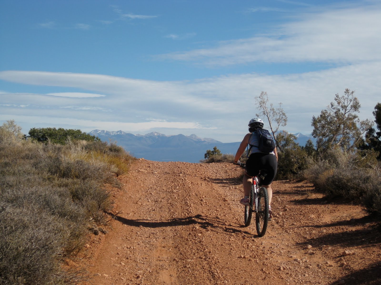
Looking south towards the Abajo mountains.

Wednesday, November 11, 2009

cause and effect

Here the Colorado River is cutting through an obvious anticline. The anticline was created when salt, deep underground, squished around and pushed sediment up.

What makes this image interesting is the potash plant. The right side of the picture shows the potash plant where they pump water down into the Paradox formation (salt from the Permian) The left side of the picture shows the vivid blue evaporation ponds. Water filled with paradox brine comes up to the surface evaporates away and leaves the salt behind.


Tuesday, November 10, 2009

misconceptions and difficult concepts


Last weekend we were riding bikes between the Anticline overlook, Canyonlands overlook and the Needles Overlook in the Canyon Rims National Recreation area.

Looking just above the Colorado River towards the Islands in the Sky, you can see a white strip creating a rather wide bench. The bench is named the White Rim and the rock unit is named after the bench. The sandstone is a brilliant white (hence the name) quartzose. In early Permian times, this region was a great inland sea of sand.

When I talk with teachers and students they almost universally understand that sediment was originally deposited horizontally. Most can at least intellectually understand the geologic time scale. What they don't seem to understand is that the rock unit does not exist in all places. Most of my students expect the White Rim, Wingate, Chinle etc to be found in all areas of the Colorado Plateau.

What seems to happen though in the translation from my field lecture (pointing, waving and talking) to their brains is that they believe that each rock unit is of equal depth for its entirety. It is only through much diagramming of sea level change and beach strands moving all over the state for me to get the bulb to light up. In this case, the White Rim's showcase is here on the Rim itself. As you travel north and east the rock unit itself thins out to nothing.

For a more in depth look at the geology of the White Rim sandstone visit Geotripper.